A full version program for Android, by d3sarrollo.net.
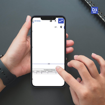
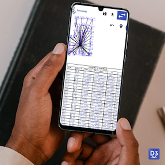
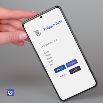
GPS Topography is a powerful tool for the construction, agricultural, and forestry industries. It is an indispensable reference for field survey, especially when the terrain is hilly or mountainous. The app allows users to take full advantage of the Android platform by using the device's built-in camera to capture GPS coordinates and measure areas.
It offers a range of measurements, such as area, distance, elevation, and volume. Users can also create and store a list of items to be measured later. Additionally, it supports polygon and circle measurements.
GPS Topography is designed to be the perfect tool for the fields, allowing users to measure any type of area and distance and store the data in a simple and intuitive way.